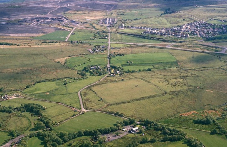
Oblique aerial photograph taken roughly north (foreground) to south by C.R.Musson, 1990. This is part of the plateau at the top of the Dulais Valley at about 250m, 750ft altitude. The square outline of the Roman fort can be seen clearly in the foreground. The Roman Road (Sarn Helen) continues directly south and climbs through the terraced street of today’s Roman Road, Banwen, before ascending the Hirfynnydd mountain. On the other side (unseen) is the village of Glynneath. On the right of the photograph is today’s village of Dyffryn Cellwen, before which can be seen the field of Banwen Rugby Club, in roughly symmetrical and somewhat appropriate gladiatorial counterpoint to the Roman fort. In front of that is today’s Inter-Valley Road, only built in 1928, running roughly west to east through the centre of this photograph.
The original Maesmarchog Colliery and associated little settlement of Tir Bach was a little to the top left of Roman Road, the patch at the top centre of the photograph where the vegetation cover appears lighter. No trace of the colliery or any other buildings can be seen now.
On the upper left hand side, open cast mining operations are operational in 1990.
©Crown copyright: Royal Commission on the Ancient and Historical Monuments of Wales. Reproduced here under Licence no: RCPL2/3/62/022.
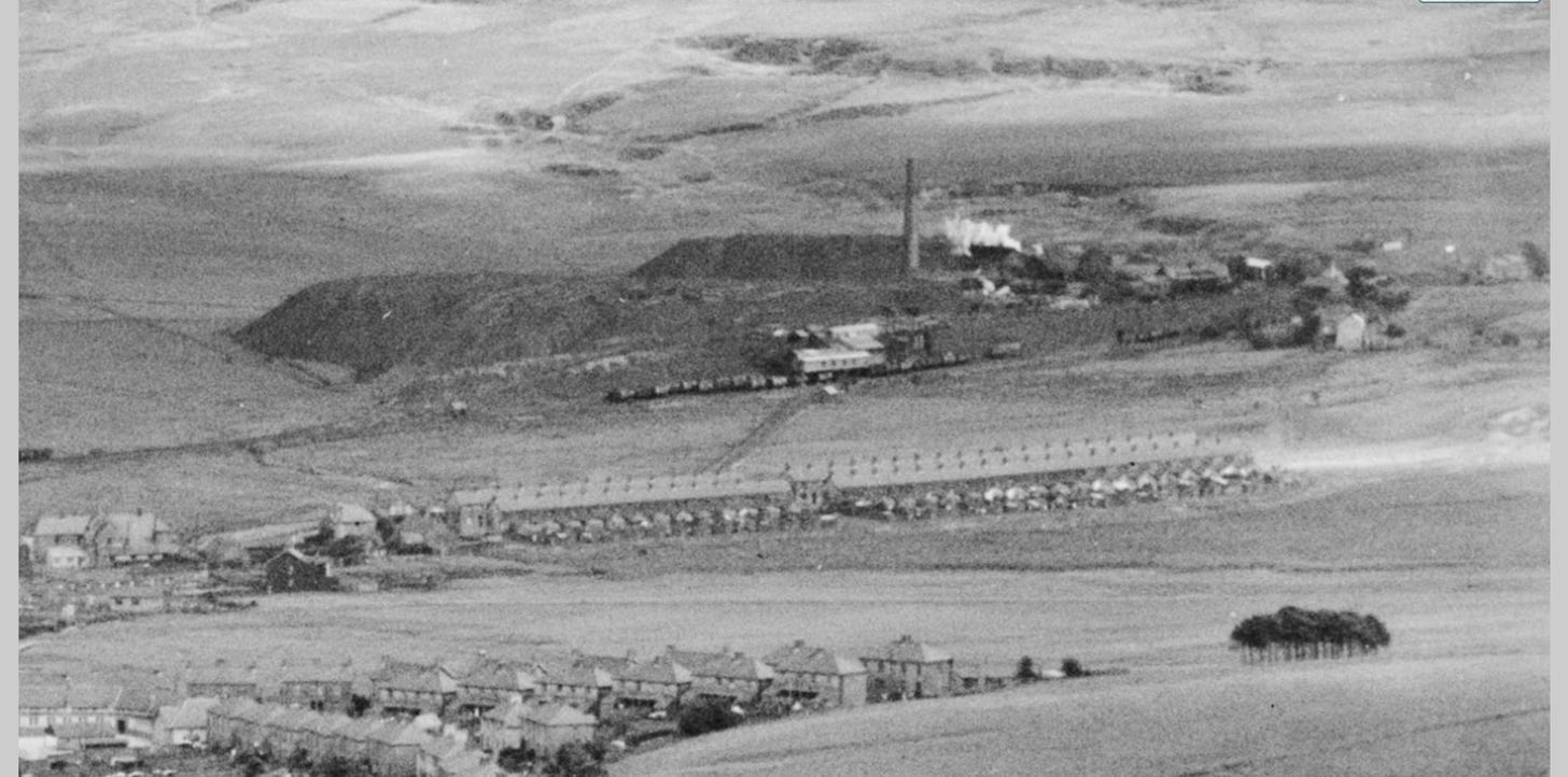
A very rare and historically fascinating view of Banwen from about 1935. In the foreground are the more “modern” houses of today’s settlement of Dyffryn Cellwen. In the middle to the extreme left is the rear of the large Pantydrainnen Hotel (Public House), demolished in 2003. A little to the right of this, with a dark gable end and two windows is “Maple House”, once the mine manager’s residence. Most of the mid-ground is occupied by the recognisable terraced houses of Roman Road, which still exist. What is special about this depiction are the colliery workings of Onllwyn No. 3 (Banwen) in the background which are a little to the southeast of Roman Road. There is no absolutely no trace of any of these now. Only what looks like a rough track running diagonally from Roman Road to the colliery is mirrored in a road today which leads to the DOVE Workshop. On the right of the photograph, and following old maps, we can discern the settlements of Pantydrainnen Farm and Tir Bach, the latter of which was where our Jones ancestors were first recorded in 1841.
With thanks to Andrew Heale and acknowledgement to Britainfromabove.org.uk; extract reproduced under given permissions.