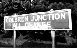
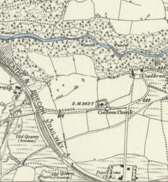
In the mid 1870s, Coelbren was still very much in its infancy. The small beginnings of a nucleated village settlement can be seen at the bottom of the map around the Price’s Arms, itself repositioned pragmatically from elsewhere, around the strategic railway junction just off the map to the south served since 1873 by the Neath & Brecon and the Midland line which provided an impetus to development. In the middle of the map, Coelbren Church had been here for centuries, usually known as Capel Coelbren, a chapel of ease from St Davids at Ystradgynlais, but never acting as a focal growth point.
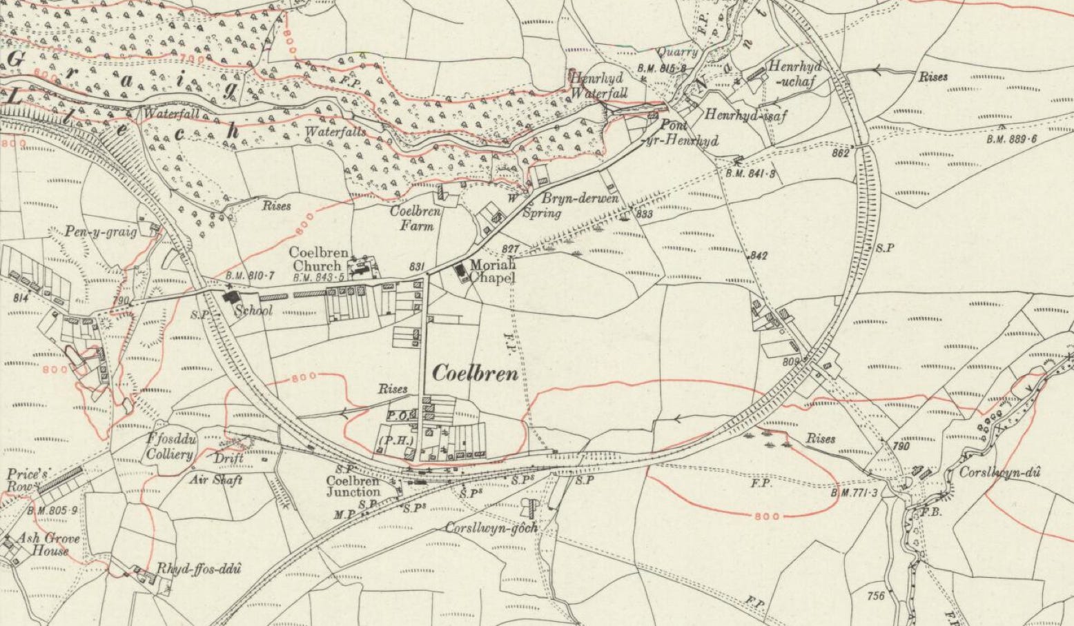
This map extract comes from the Ordnance Survey 1914-1921 6 inch to 1-mile edition. Coelbren House is the fourth house south of the “C” for Coelbren, diagonally northeast of the Price’s Arms (shown as P.H. – Public House). The house is set in generous grounds. All the major elements Coelbren would ever have are in place on this map: the railway junction, the school, Coelbren Church, Moriah Chapel and the aforementioned Public House. In 2014, the railway junction has gone and the school and chapel are closed awaiting redevelopment. The Church and pub remain open for business. The Post Office has closed and, in 2017, a recently-opened modern GP surgery was slated for closure. The National Trust has developed the Henrhyd waterfall as a well-known and popular tourist attraction.